01
Initial perception
Generate an initial farmland mask from the current remote-sensing image.
Think with Extra-Image: A Farmland Segmentation Agent Driven by Spatio-Temporal Information Gain
Official project page. Paper, checkpoints, and benchmark links will be activated upon release.
docs/assets/videos/FarmSeeker_Demo.mp4
Is segmentation failure really just because the model does not see well enough?
The answer may not be in the current image at all. A natural solution is to seek extra information gain-not by looking at more images indiscriminately, but by seeing the most critical evidence when it is truly needed.
Limited by observation time and spatial field of view, a single image may not contain the complete evidence required for reliable farmland recognition. FarmSeeker neither repeatedly mines the current image nor blindly introduces more inputs. Instead, it first localizes segmentation ambiguities, determines whether temporal cues or broader spatial context are missing, and then acquires on demand the extra spatio-temporal evidence expected to provide the greatest information gain. The newly acquired evidence is ultimately translated into more reliable farmland segmentation results.
FarmSeeker answers when extra evidence is needed, what evidence to retrieve, how to acquire it, and how to use it.
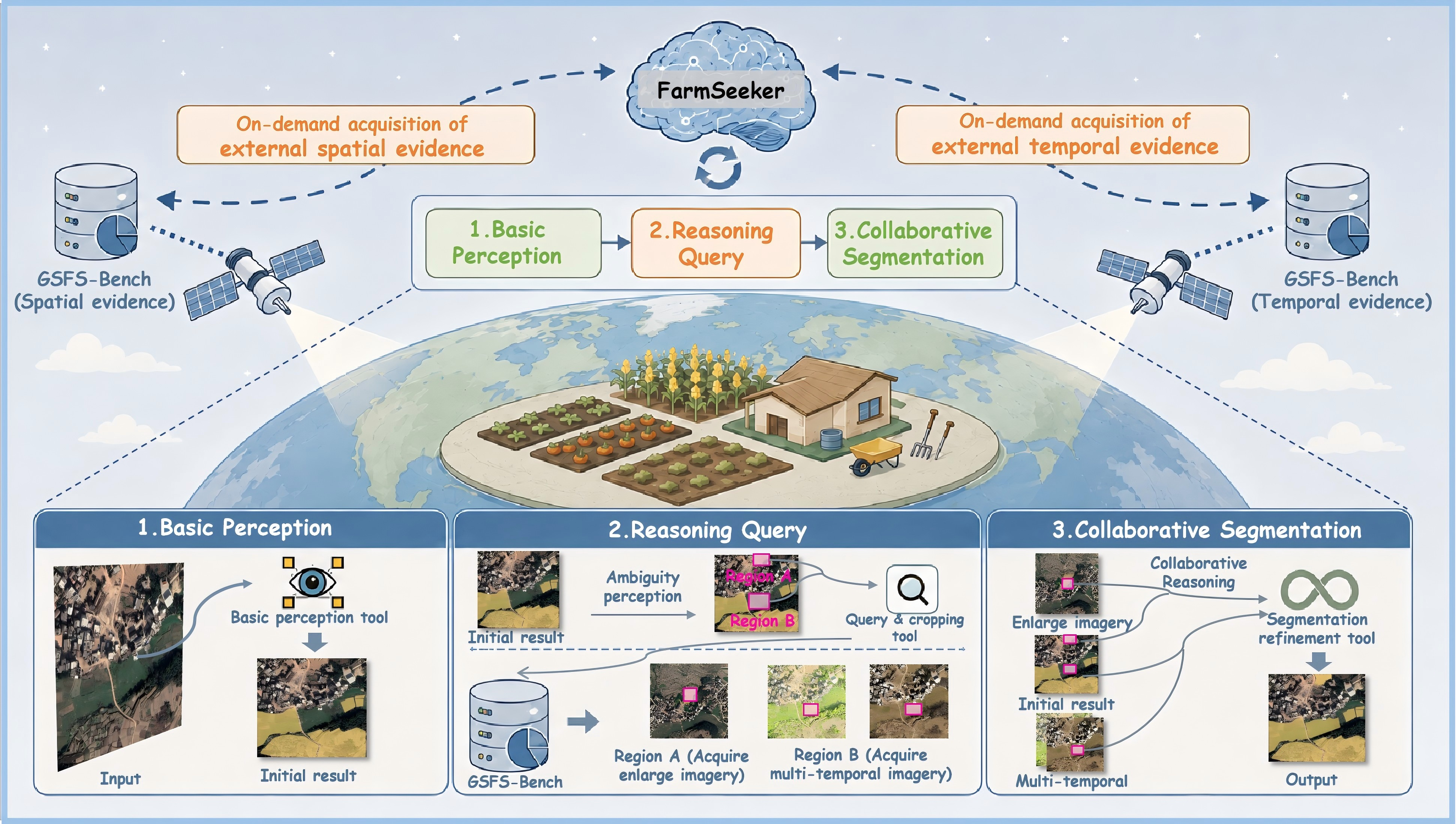
Generate an initial farmland mask from the current remote-sensing image.
Locate regions where the current observation may not support a reliable decision.
Decide whether temporal, spatial, joint, or no additional evidence is required.
Query aligned multi-temporal imagery or a wider spatial-context observation.
Reason across current and retrieved images, then locally correct the mask with SAM 2.1.
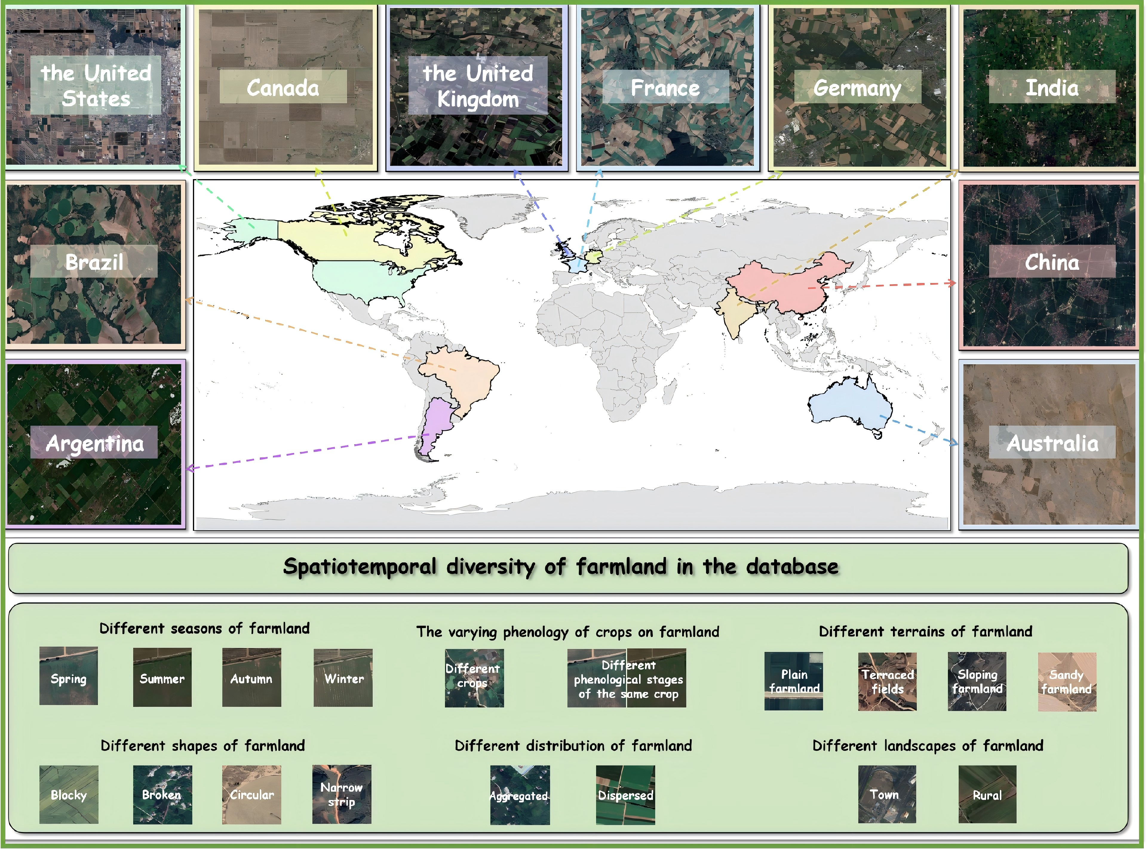
We build GSFS-Bench to evaluate ambiguity perception, evidence selection, and collaborative reasoning under realistic farmland ambiguity.
Evaluation samples cropped to 512×512 from high-resolution remote-sensing imagery.
High-resolution observations suitable for fine-grained farmland interpretation.
Scenes span multiple major agricultural regions with diverse climates and field patterns.
Each sample is associated with spatial and temporal evidence pools for on-demand retrieval.
| Subset | Purpose | Annotation / Supervision |
|---|---|---|
| General Evaluation Set | Farmland segmentation performance | Pixel-level farmland masks |
| Ambiguity Perception Subset | Evaluate whether the model can localize unreliable regions | Reference ambiguity regions |
| Tool-Calling Subset | Evaluate whether the model requests the correct evidence type | Temporal / spatial / none labels |
| Collaborative Reasoning Subset | Evaluate whether the model can use retrieved images to revise its decision | Multi-image reasoning samples |
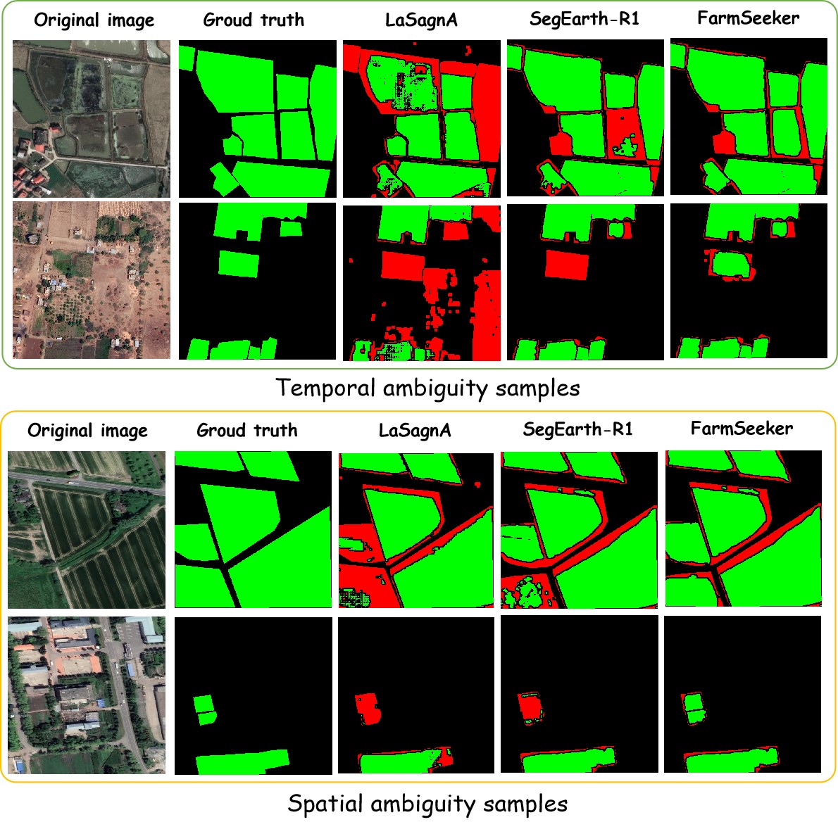
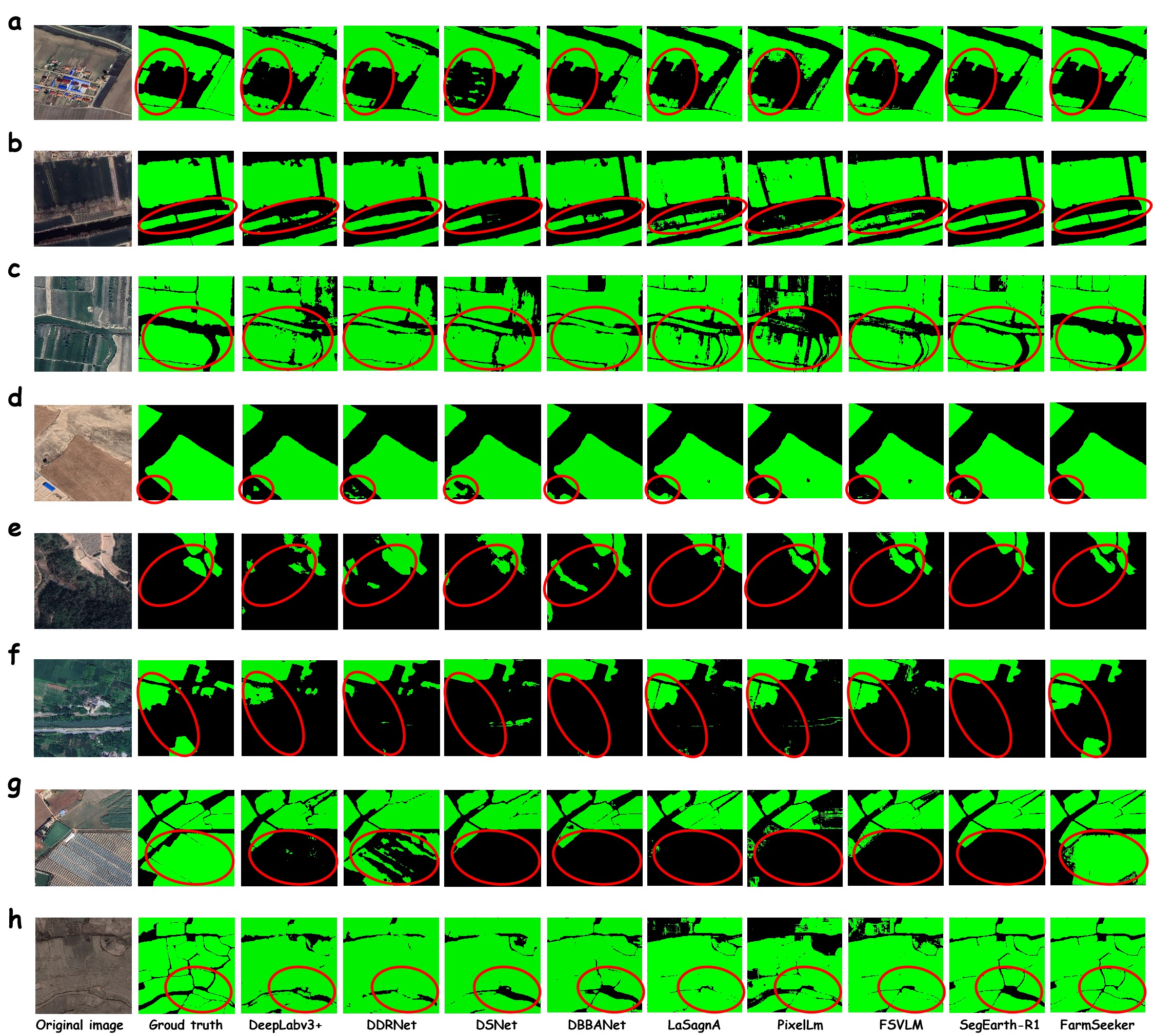
Qualitative comparisons demonstrate the effectiveness of FarmSeeker in resolving both spatio-temporal ambiguity and challenging farmland boundaries across diverse agricultural regions.
The final BibTeX entry will be updated after the paper record becomes public.
@misc{wu2026thinkextraimagefarmlandsegmentation,
              title={Think with Extra-Image: A Farmland Segmentation Agent Driven by Spatio-Temporal Information Gain},
              author={Haiyang Wu and Weiliang Mu and Zhuofei Du and Dandan Zhong and Kaijie Shi and Haifeng Li and Chao Tao},
              year={2026},
              eprint={2607.28186},
              archivePrefix={arXiv},
              primaryClass={cs.CV},
              url={https://arxiv.org/abs/2607.28186},
        }